
Ask Meshy or Tripo for "a dramatic alpine mountain" and about eight seconds later you have one. It will be good. Genuinely, surprisingly good — plausible ridgelines, convincing erosion, a texture that would pass in a game.
Now ask for the Matterhorn.
You will also get a mountain. It will have a pointy bit. It will not be the Matterhorn, and if you have ever stood in Zermatt you will know within about a second. The proportions are wrong, the Hörnli ridge is not where it lives, and the four faces that make that mountain the most recognisable rock on Earth are just… faces.
This is not a criticism of the tools. It is a description of what they do.
Generation and measurement are different jobs
An image-to-3D model has learned what mountains look like. It has seen a very large number of them and can produce a new one that is statistically mountain-shaped. That is a real and useful capability.
What it has not got is a survey. Nobody flew a radar over the model's training data and recorded that this particular ridge is at this particular altitude. So when you ask for a named place, the model does the only thing it can: it generates something plausible and labels it with your prompt.
For a fantasy landscape, plausible is exactly right — better than right, because you can iterate on it in seconds. For a real place, plausible is the one thing you do not want. The entire value of a map of somewhere you know is that it is correct. It is your valley, with your ridge in the right place, and the moment it is merely mountain-shaped it stops being a map and becomes an ornament.
The other problem: AI meshes are usually not printable
There is a second, more mundane issue, and it is well documented by the people building these tools. A generated mesh is typically non-manifold: it has holes, flipped normals, floating fragments and self-intersections. Your slicer either refuses it or produces something structurally wrong.
This is not a fringe complaint. It is the headline feature the AI companies compete on — Meshy advertises a printability check and auto-repair precisely because raw output so often needs it. Both they and Tripo now foreground watertightness, which tells you how much of a problem it has been.
Why does it happen? Because these systems produce a surface that looks like a solid, and looking like a solid and being one are different properties. A renderer does not care about a hole it cannot see from the camera. A slicer cares enormously, because it has to decide what is inside.
What "watertight" actually means, and how to check
A solid you can print has one property: every edge belongs to exactly two triangles. An edge used once is a hole. An edge used three times means surfaces passing through each other. Either way the slicer cannot tell inside from outside.
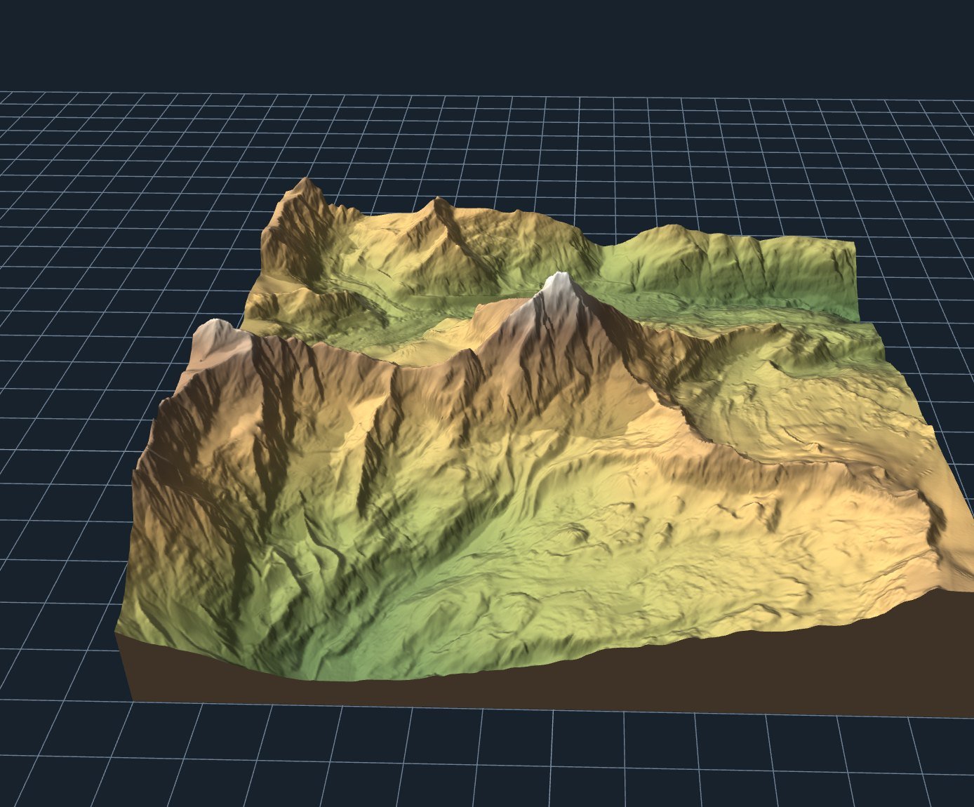
I exported the Matterhorn above as an STL and took it apart to check. Binary STL stores no vertex indices — every triangle carries three raw coordinate triples — so the check means quantising the coordinates, rebuilding the edge list and counting:
And then the detail I enjoyed more than I should have. Euler's formula says that for any closed surface without holes through it, vertices minus edges plus faces equals two:
Exactly two. Not approximately. That mesh is mathematically a closed solid — topologically a sphere, pushed into the shape of a mountain — and it got there without a repair step, because it was built as a solid rather than generated as a surface and patched afterwards.
That is the real difference. The geometry comes from a heightfield with walls dropped round the edge and a floor closed underneath. There is no stage at which a hole could appear, so there is no stage at which one needs fixing.
So where is AI genuinely good?
I do not want to leave this sounding like a hit piece, because these tools are impressive and I use them.
AI generation wins wherever plausible is the goal: characters, creatures, props, ornaments, concept work, anything where "does it look right" is the only test and there is no ground truth to be wrong about. Eight seconds to a usable mesh is transformative for that work, and no amount of survey data helps you design a dragon.
Measured data wins wherever correct is the goal: your town, the mountain you climbed, the coastline you grew up on, the route you walked last summer. Nobody can generate those, because the information is not in the model. It is in the measurements.
| You want | Use |
|---|---|
| A dragon, a bust, a planter, a prop | AI generation. Fast, and there is nothing to be wrong about |
| A fictional landscape for a game or diorama | AI generation, or noise-based terrain tools |
| A real, named place | Elevation data. Generation cannot know it |
| A functional, dimensioned part | CAD, or text-to-CAD. Not mesh generation |
The honest test
If you are wondering whether a generated model of a real place is good enough, there is a quick way to find out: show it to somebody who knows the place. Not a photo of it — the model.
People hold extraordinarily precise mental maps of ground they have walked. They will not be able to articulate what is wrong, and they will know immediately that something is. That reaction is the entire reason to print a map of somewhere real, and it is the one thing a plausible mountain cannot buy.
Make a dragon with AI. It will be a better dragon than you could model yourself. But make your valley from the survey.
Further reading
If you want to go deeper on the current state of generation: 3DPrinting.com's roundup of AI generators for printing is a reasonable survey, and there is a critical case study on arXiv testing what text-to-3D and image-to-3D prompts actually produce. Both are worth the time, and neither claims these tools know where your mountain is.