
3D printed ski resort maps have become a genuine cottage industry. Breckenridge and Vail sell on Etsy for around $330 each, and outlets from Powder to Yahoo have run "already Christmas shopping?" pieces about them. They are lovely objects and the price is not unreasonable for a framed, finished piece.
They are also about two pounds of filament and an afternoon, if the resort you want is not one of the dozen anybody stocks.
Why ski terrain prints so well
Ski resorts are close to the ideal subject for a relief print, and not by accident. A resort exists because the mountain has a particular shape: sustained fall line, enough vertical, bowls and ridges that make sense to ski. Those are exactly the features that survive being shrunk to 150 mm.
Better still, the vertical drop is the number skiers already care about. A resort advertising 1,000 m of vertical is telling you, in advance, that your model will have real relief.
Size it to the skiable area
Most resorts fit comfortably in 8 to 14 km. That is tight enough to keep the vertical dramatic and wide enough to hold the whole lift network.
| Resort | Frame | Why |
|---|---|---|
| Vail | 11 km | Front side plus the Back Bowls |
| Chamonix | 16 km | Needs the whole valley and the massif above it |
| Breckenridge | 9 km | Peaks 6 through 10 in one frame |
| Zermatt | 14 km | Only works with the Matterhorn in shot |
| Verbier | 12 km | Four valleys, so it needs the width |
| Whistler Blackcomb | 13 km | Two mountains, and the gap matters |
Rotate the frame rather than leaving it north-up. A resort has a direction — the fall line, the valley — and squaring the frame to that instead of to the pole makes a noticeably better object. Almost nobody does this and it is the single easiest improvement.
Chamonix, and the case for going bigger
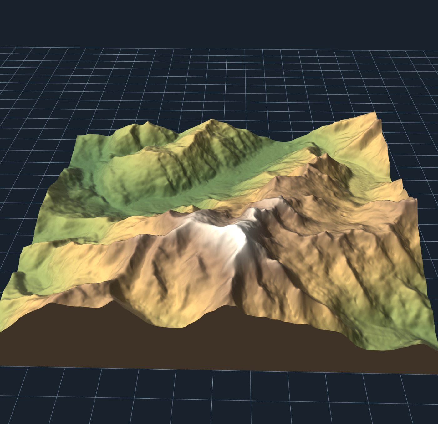
Chamonix is the argument for occasionally breaking the 8–14 km rule. The resort itself is smaller than that frame, but the massif is the reason anyone goes, and cropping it out to keep the pistes tight would produce a worse object. Judge by what makes the place recognisable, not by the lift map.
Exaggeration: leave it alone
Alpine resorts almost never need it. Chamonix at 1× already gives 37 mm of relief; Vail's 1,187 m of range across 11 km gives about 16 mm, which reads fine.
Where you may want 1.5× to 2× is smaller hills — Midwest and UK resorts, Scottish ski areas, Scandinavian hills — where 200–400 m of vertical across a wide frame genuinely does disappear. Above roughly 800 m of range, stay at 1×. Exaggerated alpine terrain looks like a cartoon and, more practically, the steep faces start showing hard layer banding.
Marking the runs
This is the honest limitation, so here it is plainly: piste lines are not in OpenStreetMap consistently enough to rely on. Some resorts are mapped in detail, many are not, and coverage of lifts is better than coverage of runs. You cannot assume the trails will be there.
Three things that do work:
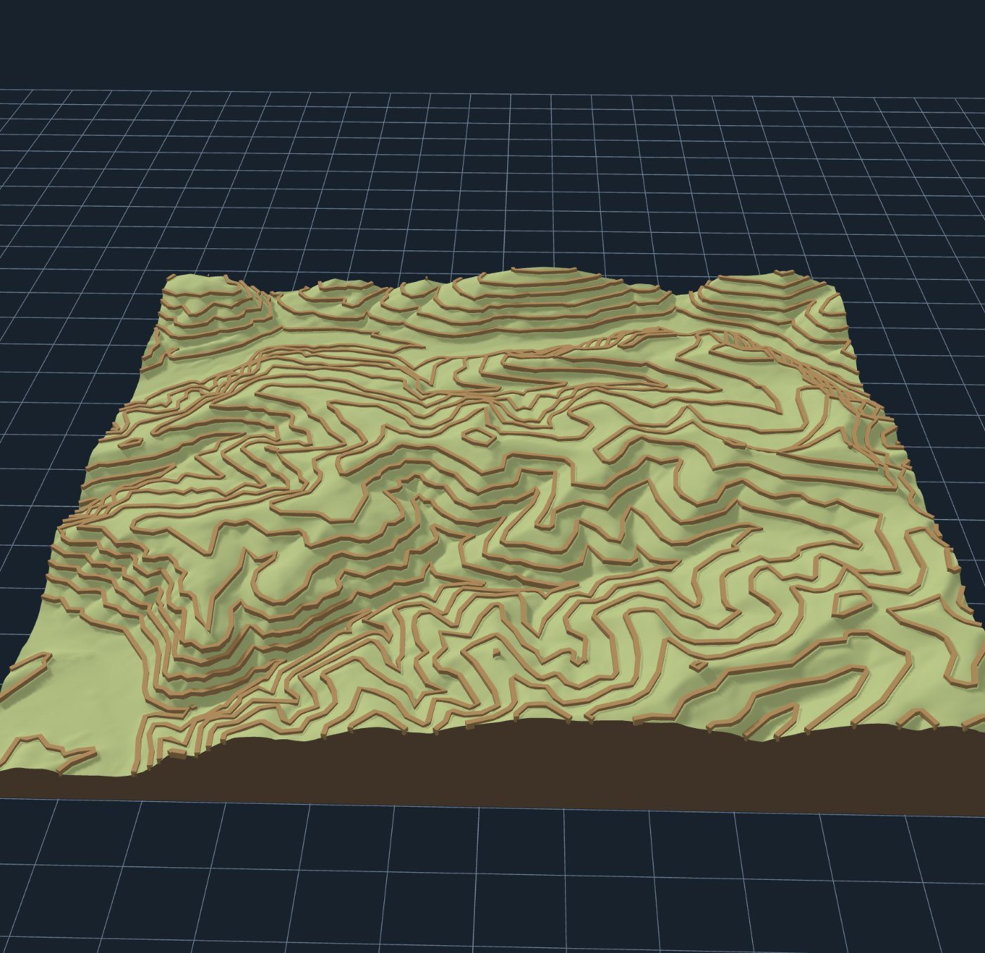
- Contour lines. The most reliable way to make terrain legible, and they come from the elevation data, so they exist everywhere. This is what the picture above uses.
- Your own GPX. If you have a season's worth of tracks from a ski watch, import them and raise them as ribbons. A model showing the runs you actually skied beats a generic piste map comprehensively as a gift. More on route prints here.
- Paint them after printing. A fine brush and the resort's own colour coding, on a matte white print. More work, and the best-looking result by a distance.
Printing it
Standard terrain settings: 0.16 mm layers, three perimeters, 12% infill, 4 mm base, brim over 150 mm. No supports — it is a heightfield, so nothing overhangs no matter how steep the couloir looks.
Two ski-specific notes. First, print it white or bone rather than grey; snow is the obvious read and matte white photographs beautifully. Second, if you have a second colour, put a change at the layer matching the resort's base elevation — everything above the lifts in white, everything below in grey or green. It shows the treeline without a single label, and it is the trick that makes people pick the thing up.
Timing, if this is a gift
It is late September. Northern-hemisphere ski season opens in six to ten weeks and Christmas is three months out, which is the exact window when the commercial sellers start their runs. A resort print for somebody who skis is a genuinely good present, and the version with their own tracks on it is better than anything available to buy.
Allow a couple of evenings: one to settle the frame and print a test tile, one for the real thing.
Making one
Open the map maker framed on Vail, or drop in your own resort's coordinates. Switch on contour lines under Layers, rotate the frame to suit the mountain, set the print width and export.
Free, no account, and the model is built in your browser rather than on anyone's server. The $330 version is a nicer frame.